Google Earth navigation
Pacific cruiser Rory Garland uses a range of new techniques to navigate safely in far-flung places with poor chart coverage
In these situations the navigator needs to piece together every available bit of information in advance and Google Earth navigation is the way to go. We have been sailing our Grand Soleil 52, Streetcar, in the Pacific for over two years. During this time we have adopted a range of new techniques to supplement standard navigation and pilotage practices using publicly available satellite imagery to fill in the gaps and give us the confidence to explore off-chart.
Most people are familiar with using Google Earth satellite imagery to explore on land, or even to see into their neighbour’s garden. Many cruisers are now finding satellite imagery can help with navigation. Coverage extends over coastal waters and captures most of the reefs and rocks associated with the land.
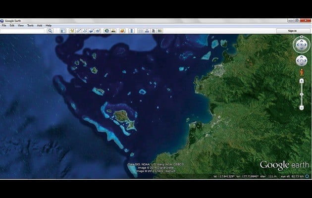
On this Google Earth image reef systems and shallows appear as light blue areas on the western side of Fiji
In tropical zones the water is clear enough for shallow areas to be visible on satellite imagery. Even in murky lagoon water suspicious discoloured patches can be identified. Conveniently, satellite images can be easily referenced to WGS84 for plotting GPS positions.These features combine to provide a powerful tool to support navigation and pilotage.
Getting the technology right
In our navigation station we use a PC with a Garmin puck-type GPS plugged into the USB. Reception is good enough from the chart table, …read more